



Thanks Mom!
Saturday
Rideau Trail kilometres 144.9-153.0 Murphys Point Provincial Park
Thanks Mom for being the safety marshall.
Yesterday morning there was zero snow cover in Ottawa. I took advantage of the 9cm dump of snow overnight and headed out at 06h00. I began at parking lot at the provincial park which is now more than a kilometre distant from the newest alignment of the Rideau Trail.
From the Cumberland library, I have borrowed The Rideau Trail Guidebook for 2006. As I hike the trail, I travel only the current portion. However, as long as I can, I will track the kilometres using the markers from the 2001 guidebook.

The new alignment in the park follows mostly nordic trails. Rocks under the ski trails were barely hidden and that may explain why the park was not actually open. In the private lands north of the park, things are rugged: deadfall and sharp rocks. Some animal has been chewing trail flashes. I turned back at the place I drove the car into the ditch on Narrows Lock Road back in February '04.

On the way back, I had hoped to carry my snowshoes and stroll down Lally's Lane. However, the depth of snow required snowshoeing the whole way.
During the outing, 58:29 was at level 3. After more than four full days of rest, my left knee pain didn't lessen.
Rideau Trail kilometres 67.4-76.1 Opinicon
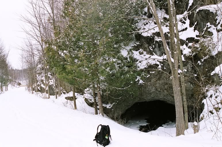
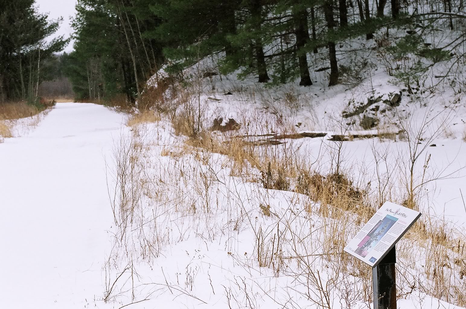
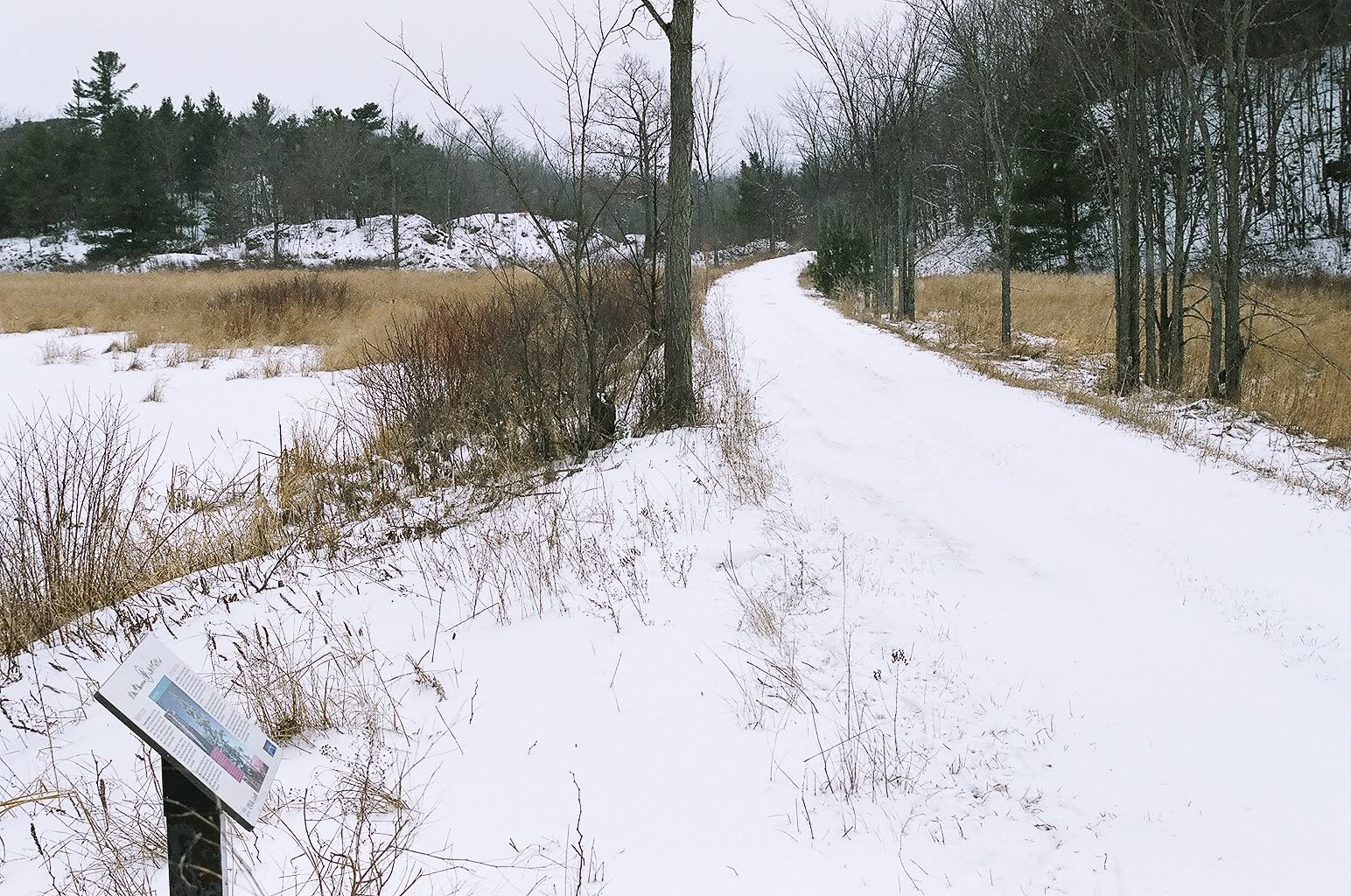
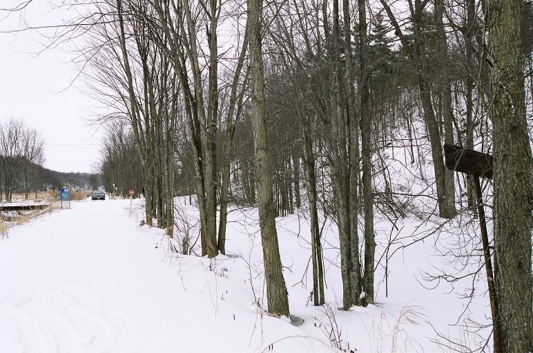
The second adventure of the day began where the former CN Smiths Falls subdivision crosses MacGillivray Road. I headed towards Ottawa, turning south off the rail embankment after 3.5k. Here in quick succession, the trail climbs two nasty descent-ascents, meaning the hiker gets a bad scare in both directions. The next 30 minutes brought more such dangers. I have orienteered in greater danger but not after hours of carrying a heavy pack on weary legs. The descents should have had more mention in the guidebook. Take the blue trail, staying on the rail bed, Cataraqui Trail, Trans Canada Trail.
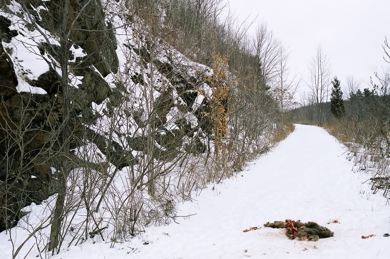
Were these marks made by sliding otters???


By the time I got to the intersection with the Upper Rock Lake Side Trail (visited a year ago), I had had enough of that segment of the RT forever. I took the blue side trail to Opinicon Road, took off the snowshoes and walked the 7k (68:23) to the trail junction with Maple Leaf Road. This walk on pavement is included in the average heart rate but not in the time & distance data here. I was in zone 3 for 58:02.
The only problem with the long walk is that I had to visit the same stretch of trail and same loud dogs that I visited in March '04.
Sunday
Rideau Trail kilometres 63.5-58.9 Frontenac Provincial Park
I was late getting going this sunny morning. Today's adventure began from the Perth Road heading to Frontenac park. I set out at an easy pace (only 14:24 at level 3) hoping to be out longer than yesterday but it was not to be.

Sunglasses on, parka off: conditions were great but my motivation was not. I miss Somebody! I bailed and turned back above the descent to the bridge across Caldwell Creek. Had I brought my nordic poles, I may have tried the descent.

Monday
Rideau Trail kilometres 41.7-47.8 Gould Lake Conservation Area
I began at the Field Studies Centre barn and actually back-tracked the Rideau Trail to where I had stopped in January last year. I did not carry nordic poles because I assumed the route was on nordic trails. These were NOT ski trails.


Out bound, I took the Ridgewalk and then the main trail upon return. Snow cover was thin on both routes. Just beyond east intersection with the Ridgewalk is a vertical climb to a lookout. My maximum heart rate was during that climb. Coming back, I orienteered around the outcrop using an old trail marked by yellow metal disk flashes.
For good or bad, there was no snow cover along Bedford Road so I headed back. I likely didn't have the energy to carry on anyways.
Rideau Trail snowshoe mission in review
19 Mar 2007: 41.7-47.8 Gould Lake - Bedford Road
18 Mar 2007: 63.5-58.9 Perth Road - Caldwell Creek, Frontenac Park
17 Mar 2007: 67.4-76.1 Opinicon - Maple Leaf Road
17 Mar 2007: 144.9-153.0 Murphys Point - Narrows Lock Road
07 Mar 2007: 279.2-279.7 Stony Swamp Score-O map
18 Feb 2007: 277.2-279.2 Stony Swamp w/ my darling
17 Feb 2007: 166.7-164.9 Frizell Road - Tay Canal
17 Feb 2007: 179.9-176.3 Wildlife & Ferrier Roads
24 Jan 2007: 183.9-185.4 Port Elmsley Drive-In - Beveridge Lock
12 Mar 2006: 76.1-81.5 Upper Rock Lake - Wagon Loop
11 Mar 2006: 114.0-125.8 Narrows Lock Road - Perth Road
15 Jan 2006: 113.0-114.0 Perth Road - Mountain Road
08 Jan 2006: 32.0-41.7 Sydenham - Gould Lake Conservation Area
07 Jan 2006: 191.5-195.1 Hillcrest Cemetery - Poonamalie Road
27 Dec 2005: 261.0-262.7 Richmond Lagoon
24 Dec 2005: 200.1-207.3 & 208.8-210.0 Wood Road, Matheson Drive & Smiths Falls
11 Dec 2005: 87.1-95.7 Chaffeys Locks - Massassauga Road
12 Mar 2005: 280.9-281.9 Robertson Rd
19 Feb 2005: 81.5-87.1 Chaffeys Locks - Wagon Loop
05 Feb 2005: 256.8-258.3 Richmond
date? 283.1-284.1 Corkstown Rd w/ my love
16 Jan 2005: 265.0-262.7 & 208.9-207.3, from Twin Elm rugby park then drove to cover side of Rosedale Rd S
10 Jan 2005: 290.6-291.8 former CPR Carleton Place subdivision
08 Jan 2005: 279.7-280.9 Stoney Swamp w/ my love
21 Mar 2004: 225.7-230.1 Dwyer Hill Rd to Flood Rd
07 Mar 2004: 66.6-67.4 Maple Leaf Rd & CNR Smiths Falls sub, too many dogs & too little snow
06 Mar 2004: 132.8-140.7 Murphy's Pt Prov Pk to Big Rideau North Shore Rd, too wet to continue to Cooper Dr
04 Mar 2004: 9.4-14.0 14.2-14.4 15.3-16.3 Kingston Twp avoiding open water in fields
29 Feb 2004: 163.1-164.9 166.7-168.9 191.5-190.9 Ferrier Rd & Wild Life Rd to Scotch Line then to Poonamalie Rd but too many dogs
28 Feb 2004: 172.0-176.3 Tay River
25 Feb 2004: 186.8-190.9 from Port Elmsley
22 Feb 2004: 183.9-179.9 Tay Canal
13 Feb 2004: 297.8-301.1 Ottawa River
11 Feb 2004: 274.4-277.2 Lime Kiln trail
10 Feb 2004: 297.8-295.5 Ottawa River
08 Feb 2004: 140.7-144.9 Murphy's Pt
07 Feb 2004: 158.4-153.0 car stuck in snow off Narrows Lock Rd
01 Feb 2004: 163.1-158.4 from Ferrier Rd
22 Jan 2004: 267.5-265.0 old Richmond Rd @ night
15 Jan 2004: 257.4-261.0 Richmond village
12 Jan 2004: 293.6-295.5 ex CPR Carleton Place sub
11 Jan 2004: 292.7-293.6 Britannia
10 Jan 2004: 210.0-213.8 Long Bush
09 Jan 2004: 213.8-218.0 McConnell Rd
08 Jan 2004: 230.0-234.7 mile trek to trail off Flood Rd, lots of rocks
07 Jan 2004: 234.7-238.0 Marlborough Forest by head lamp, too many branches
04 Jan 2004: 218.0-221.9 Gilroy Rd
03 Jan 2004: 221.9-225.7 Dwyer Hill Rd
02 Jan 2004: 284.1-288.1
21 Dec 2003: 291.4-292.7 Britannia
20 Dec 2003: 251.2-256.8 245.1-248.0 Franktown Rd, lost glove back thru Ottawa St swamp then drove to Kettles Rd
06 Dec 2003: 238.0-245.1 Ruffed Grouse Trail
05 Dec 2003: 267.5-272.3
30 Nov 2003: 304.0-304.3 trail head Richmond Landing
29 Nov 2003: 256.8-257.4 251.2-248.0 244.7-244.3 Jock Trail & Munster Rd, very little snow cover
15 Jan 2003: 301.1-303.2 Remic Rapids
At this rate, I project the mission continuing into January 2009. However, 45% of what is left to hike is more than two hours away by car. In addition, half of the remaining trail is on pavement. It is a challenge to plan snowshoeing along roads when there is adequate snow cover.
kilometres completed = 223.8 74%
9.4-14.0 14.2-14.4 15.3-16.3 32.0-47.8 58.9-63.5 66.6-95.7 113.0-125.8 132.8-168.9 172.0-185.4 186.8-195.1 200.1-261.0 262.7-272.3 274.4-281.9 283.1-288.1 290.6-303.2 304.0-304.3
Rideau Trail kilometres 144.9-153.0 Murphys Point Provincial Park
Thanks Mom for being the safety marshall.
Yesterday morning there was zero snow cover in Ottawa. I took advantage of the 9cm dump of snow overnight and headed out at 06h00. I began at parking lot at the provincial park which is now more than a kilometre distant from the newest alignment of the Rideau Trail.
From the Cumberland library, I have borrowed The Rideau Trail Guidebook for 2006. As I hike the trail, I travel only the current portion. However, as long as I can, I will track the kilometres using the markers from the 2001 guidebook.
The new alignment in the park follows mostly nordic trails. Rocks under the ski trails were barely hidden and that may explain why the park was not actually open. In the private lands north of the park, things are rugged: deadfall and sharp rocks. Some animal has been chewing trail flashes. I turned back at the place I drove the car into the ditch on Narrows Lock Road back in February '04.
On the way back, I had hoped to carry my snowshoes and stroll down Lally's Lane. However, the depth of snow required snowshoeing the whole way.
During the outing, 58:29 was at level 3. After more than four full days of rest, my left knee pain didn't lessen.
Rideau Trail kilometres 67.4-76.1 Opinicon
The second adventure of the day began where the former CN Smiths Falls subdivision crosses MacGillivray Road. I headed towards Ottawa, turning south off the rail embankment after 3.5k. Here in quick succession, the trail climbs two nasty descent-ascents, meaning the hiker gets a bad scare in both directions. The next 30 minutes brought more such dangers. I have orienteered in greater danger but not after hours of carrying a heavy pack on weary legs. The descents should have had more mention in the guidebook. Take the blue trail, staying on the rail bed, Cataraqui Trail, Trans Canada Trail.
Were these marks made by sliding otters???
By the time I got to the intersection with the Upper Rock Lake Side Trail (visited a year ago), I had had enough of that segment of the RT forever. I took the blue side trail to Opinicon Road, took off the snowshoes and walked the 7k (68:23) to the trail junction with Maple Leaf Road. This walk on pavement is included in the average heart rate but not in the time & distance data here. I was in zone 3 for 58:02.
The only problem with the long walk is that I had to visit the same stretch of trail and same loud dogs that I visited in March '04.
Sunday
Rideau Trail kilometres 63.5-58.9 Frontenac Provincial Park
I was late getting going this sunny morning. Today's adventure began from the Perth Road heading to Frontenac park. I set out at an easy pace (only 14:24 at level 3) hoping to be out longer than yesterday but it was not to be.
Sunglasses on, parka off: conditions were great but my motivation was not. I miss Somebody! I bailed and turned back above the descent to the bridge across Caldwell Creek. Had I brought my nordic poles, I may have tried the descent.
Monday
Rideau Trail kilometres 41.7-47.8 Gould Lake Conservation Area
I began at the Field Studies Centre barn and actually back-tracked the Rideau Trail to where I had stopped in January last year. I did not carry nordic poles because I assumed the route was on nordic trails. These were NOT ski trails.
Out bound, I took the Ridgewalk and then the main trail upon return. Snow cover was thin on both routes. Just beyond east intersection with the Ridgewalk is a vertical climb to a lookout. My maximum heart rate was during that climb. Coming back, I orienteered around the outcrop using an old trail marked by yellow metal disk flashes.
For good or bad, there was no snow cover along Bedford Road so I headed back. I likely didn't have the energy to carry on anyways.
Rideau Trail snowshoe mission in review
19 Mar 2007: 41.7-47.8 Gould Lake - Bedford Road
18 Mar 2007: 63.5-58.9 Perth Road - Caldwell Creek, Frontenac Park
17 Mar 2007: 67.4-76.1 Opinicon - Maple Leaf Road
17 Mar 2007: 144.9-153.0 Murphys Point - Narrows Lock Road
07 Mar 2007: 279.2-279.7 Stony Swamp Score-O map
18 Feb 2007: 277.2-279.2 Stony Swamp w/ my darling
17 Feb 2007: 166.7-164.9 Frizell Road - Tay Canal
17 Feb 2007: 179.9-176.3 Wildlife & Ferrier Roads
24 Jan 2007: 183.9-185.4 Port Elmsley Drive-In - Beveridge Lock
12 Mar 2006: 76.1-81.5 Upper Rock Lake - Wagon Loop
11 Mar 2006: 114.0-125.8 Narrows Lock Road - Perth Road
15 Jan 2006: 113.0-114.0 Perth Road - Mountain Road
08 Jan 2006: 32.0-41.7 Sydenham - Gould Lake Conservation Area
07 Jan 2006: 191.5-195.1 Hillcrest Cemetery - Poonamalie Road
27 Dec 2005: 261.0-262.7 Richmond Lagoon
24 Dec 2005: 200.1-207.3 & 208.8-210.0 Wood Road, Matheson Drive & Smiths Falls
11 Dec 2005: 87.1-95.7 Chaffeys Locks - Massassauga Road
12 Mar 2005: 280.9-281.9 Robertson Rd
19 Feb 2005: 81.5-87.1 Chaffeys Locks - Wagon Loop
05 Feb 2005: 256.8-258.3 Richmond
date? 283.1-284.1 Corkstown Rd w/ my love
16 Jan 2005: 265.0-262.7 & 208.9-207.3, from Twin Elm rugby park then drove to cover side of Rosedale Rd S
10 Jan 2005: 290.6-291.8 former CPR Carleton Place subdivision
08 Jan 2005: 279.7-280.9 Stoney Swamp w/ my love
21 Mar 2004: 225.7-230.1 Dwyer Hill Rd to Flood Rd
07 Mar 2004: 66.6-67.4 Maple Leaf Rd & CNR Smiths Falls sub, too many dogs & too little snow
06 Mar 2004: 132.8-140.7 Murphy's Pt Prov Pk to Big Rideau North Shore Rd, too wet to continue to Cooper Dr
04 Mar 2004: 9.4-14.0 14.2-14.4 15.3-16.3 Kingston Twp avoiding open water in fields
29 Feb 2004: 163.1-164.9 166.7-168.9 191.5-190.9 Ferrier Rd & Wild Life Rd to Scotch Line then to Poonamalie Rd but too many dogs
28 Feb 2004: 172.0-176.3 Tay River
25 Feb 2004: 186.8-190.9 from Port Elmsley
22 Feb 2004: 183.9-179.9 Tay Canal
13 Feb 2004: 297.8-301.1 Ottawa River
11 Feb 2004: 274.4-277.2 Lime Kiln trail
10 Feb 2004: 297.8-295.5 Ottawa River
08 Feb 2004: 140.7-144.9 Murphy's Pt
07 Feb 2004: 158.4-153.0 car stuck in snow off Narrows Lock Rd
01 Feb 2004: 163.1-158.4 from Ferrier Rd
22 Jan 2004: 267.5-265.0 old Richmond Rd @ night
15 Jan 2004: 257.4-261.0 Richmond village
12 Jan 2004: 293.6-295.5 ex CPR Carleton Place sub
11 Jan 2004: 292.7-293.6 Britannia
10 Jan 2004: 210.0-213.8 Long Bush
09 Jan 2004: 213.8-218.0 McConnell Rd
08 Jan 2004: 230.0-234.7 mile trek to trail off Flood Rd, lots of rocks
07 Jan 2004: 234.7-238.0 Marlborough Forest by head lamp, too many branches
04 Jan 2004: 218.0-221.9 Gilroy Rd
03 Jan 2004: 221.9-225.7 Dwyer Hill Rd
02 Jan 2004: 284.1-288.1
21 Dec 2003: 291.4-292.7 Britannia
20 Dec 2003: 251.2-256.8 245.1-248.0 Franktown Rd, lost glove back thru Ottawa St swamp then drove to Kettles Rd
06 Dec 2003: 238.0-245.1 Ruffed Grouse Trail
05 Dec 2003: 267.5-272.3
30 Nov 2003: 304.0-304.3 trail head Richmond Landing
29 Nov 2003: 256.8-257.4 251.2-248.0 244.7-244.3 Jock Trail & Munster Rd, very little snow cover
15 Jan 2003: 301.1-303.2 Remic Rapids
At this rate, I project the mission continuing into January 2009. However, 45% of what is left to hike is more than two hours away by car. In addition, half of the remaining trail is on pavement. It is a challenge to plan snowshoeing along roads when there is adequate snow cover.
kilometres completed = 223.8 74%
9.4-14.0 14.2-14.4 15.3-16.3 32.0-47.8 58.9-63.5 66.6-95.7 113.0-125.8 132.8-168.9 172.0-185.4 186.8-195.1 200.1-261.0 262.7-272.3 274.4-281.9 283.1-288.1 290.6-303.2 304.0-304.3
posted by elyob_ragad | 8:51 p.m.
|
1 comments
